• Skip to main content

Mike Campbell

Land / water / resource use

Main Content

Policy-congruent solutions and geospatial analysis for

Land, water, and resource
management planning

Planning work GIS work

Lorem ipsum dolor sit geospatial.

Project type: Riparian restoration planning

Future flow scenarios on the Middle Santa Cruz River
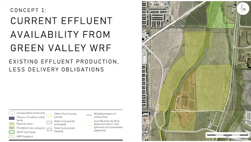
Conceptual map of in-channel flows from a wastewater reclamation facility, labeled "Concept 1: Current effluent availability."

This major project developed several riparian restoration concepts for the Middle Santa Cruz River south of Tucson, each based on one of several plausible scenarios for the availability of treated wastewater, or effluent. The report proposes various build-out scenarios and management tools for environmental benefit, water security, and drought response. The most tractable near-term option identified in this study is currently in the permitting stage.
Full report View slides

Project type: Transportation and recreation planning

Pueblo Park: Conceptual groundwork for a quick-build urban gravel bike network in the Tucson area.

Low-cost, high feasibility

An extensive network of unpaved rights-of-way is retrieved using feature-matching tools with Open Street Map. Public ownership eliminates the need for costly land acquisition.

Natural features and urban ameneties

Prospective route segments within the network are scored against proximity to amenties identified in other public data sets. These include parks, scenic washes, existing bike trails, and bike-friendly arterial crossings.

See the project poster

Project type: Water resource planning

Per acre-foot price signals for new sources of water in the West

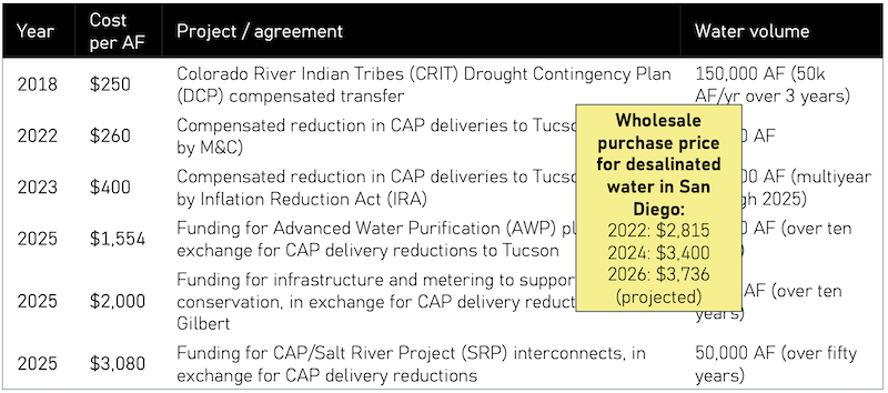
A table showing water price signals, with costs of desalinated water superimposed upon it.

Tabulated price signals for bringing new sources of water online in the West are approaching the cost of desalination.
View selected slides from presentation

Project type: Brownfield redevelopment planning

A decision-support system for publicly funded landfill redevelopment

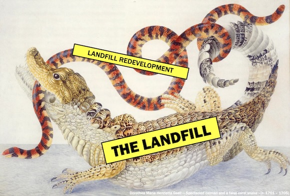
18th Century print of a false coral snake being bitten by a false caiman. The snake is labeled "landfill redevelopment" and the false caiman is labeled "the landfill."

Navigating a complex process

Municipalities considering landfill redevelopment face myriad complex issues including cleanup methods, competing land uses proposals, and even determining remediation criteria. This decision support system (DSS) is helps municipalities navigate the process. The simplifying framework considers environmental issues, social needs, and the costs of remediation.

View presentation

Project type: Mapmaking

Mike Campbell's GIS image gallery

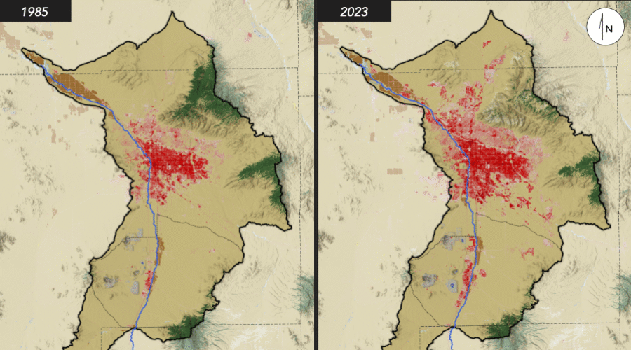
  • The National Land Cover Dataset reveals changes in land cover between 1985 and 2023 in the Tucson-area watershed.
    NLCD land-cover changes for Tucson-area watershed (detail). Click to see full image in gallery.
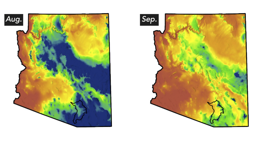
  • A cropped image from a larger set of maps showing monthly precipitation normals for the state of Arizona. This map shows a statewide drop in precipitation between August and September.
    Monthly precipitation norms, Arizona (detail). Created using PRISM 30-year climate data, 1991-2020. Click to see full image in gallery.
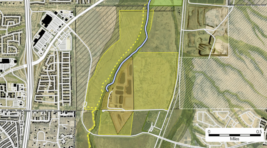
  • A close-in crop of a map shows in-channel flow originating from a wastewater reclamation facility.
    Extent-of-flow projection, Middle Santa Cruz River riparian restoration planning (detail). Click to see full image in gallery.
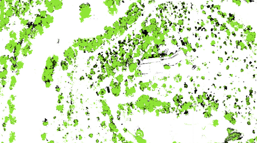
  • A map shows the extent of canopy cover and die-back on a large parcel.
    Canopy cover and die-back, via land-cover classification and 3D photogrammetric modeling (detail). Click to see full image in gallery.
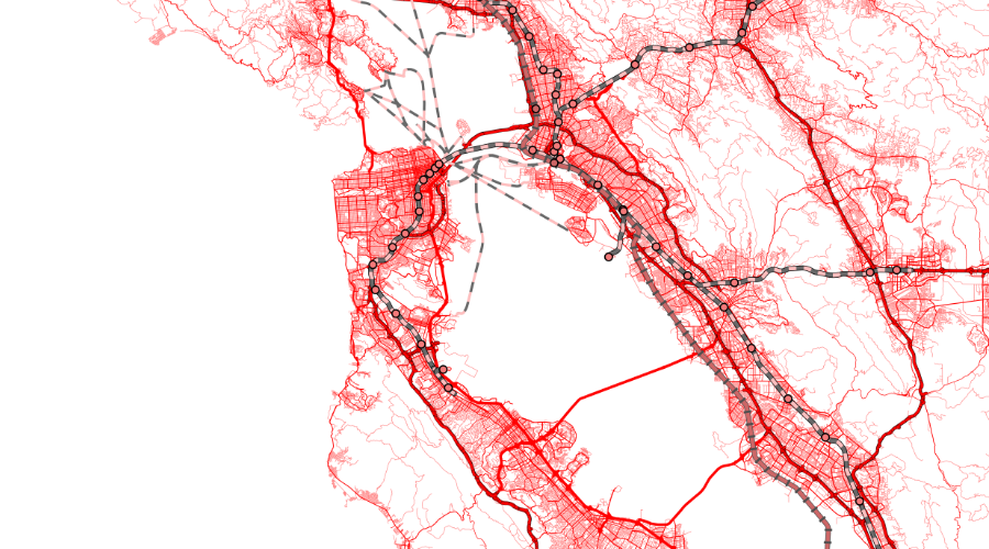
  • A map shows road networks, ferry routes, and passenger rail lines in the San Francisco bay area.
    Bay Area transportation networks (detail). Created using CalTrans datasets. Click to see full image in gallery.

Project type: Natural resource management

Ecohydrological approaches to urban resource stewardship

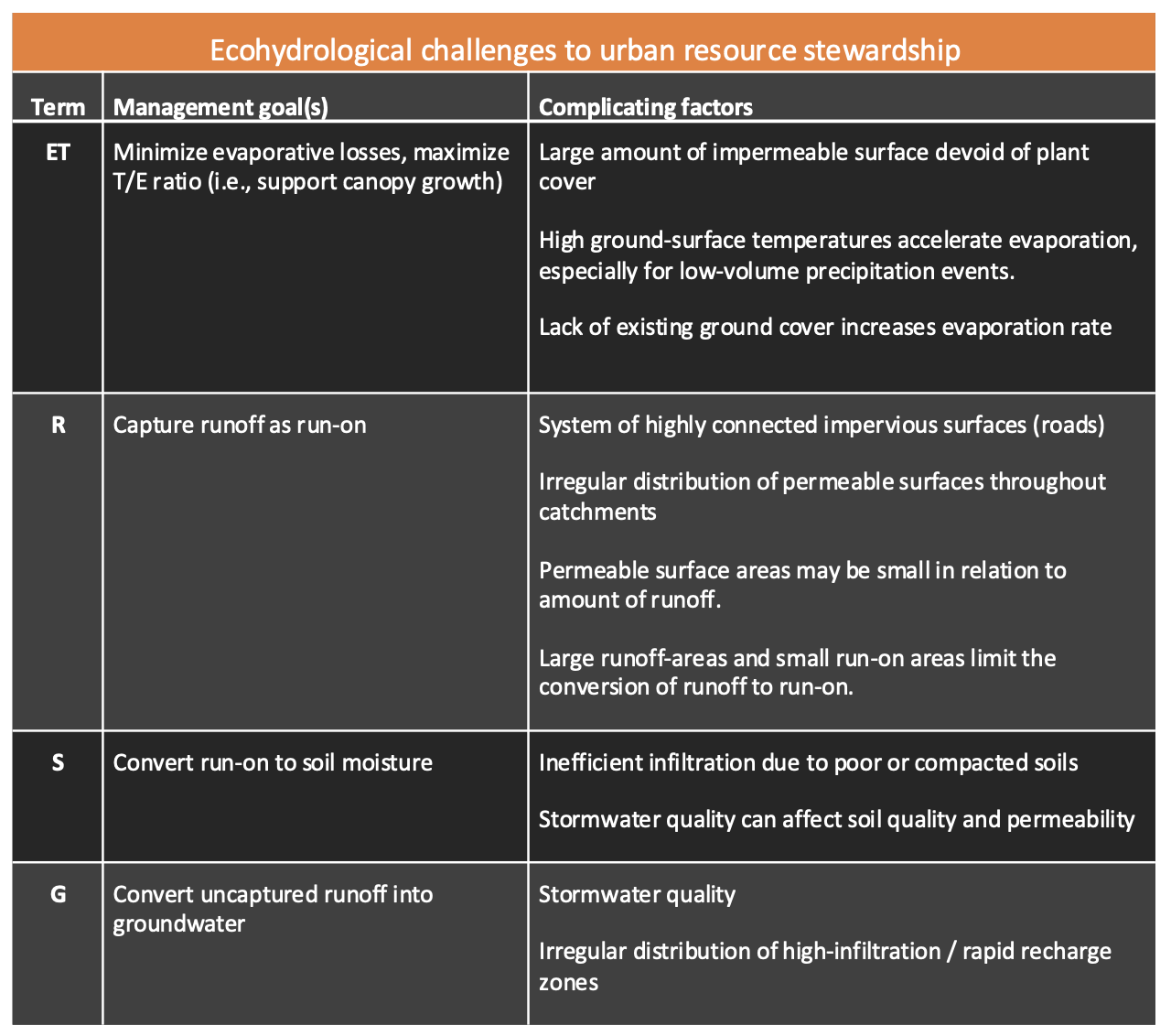
A table that shows ecohydrological challenges to water resource management in cities.

Resource management decisions by local jurisdictions have ecohydrological outcomes. This presentation reviews some differences between the ecohydrology of urban and natural areas and shows how good managment strategies relate to the water balance equation.

View presentation

Copyright © 2026 · Altitude Pro on Genesis Framework · WordPress · Log in